CHCNAV · GNSS RECEIVERS
Compare the GNSS lineup.
Four receivers, four different answers to the same question: how do you get a trustworthy position on your site? Here they are side by side.
Why these receivers earn their keep
Tilt it. Measure anyway.
IMU tilt compensation keeps the measurement true with the pole tilted up to 60°, so fences, ditches and odd angles stop slowing you down.
See your stakeout.
Visual stakeout puts the point on the controller’s camera view and walks you onto it — no squinting at numbers while you move.
Measure what you can’t stand on.
The i85’s green laser measures offset points up to 150 m away — across traffic, water or private ground you can’t put a pole on.
Keep working when the sky disappears.
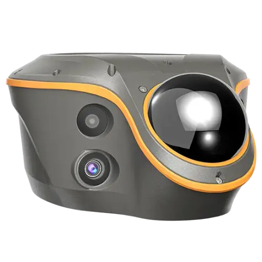
The ViLi i100 fuses LiDAR with GNSS to hold centimetre-level positions beside buildings, under canopy and in partial or fully denied sky.
Side by side
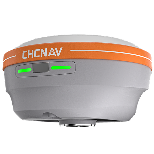
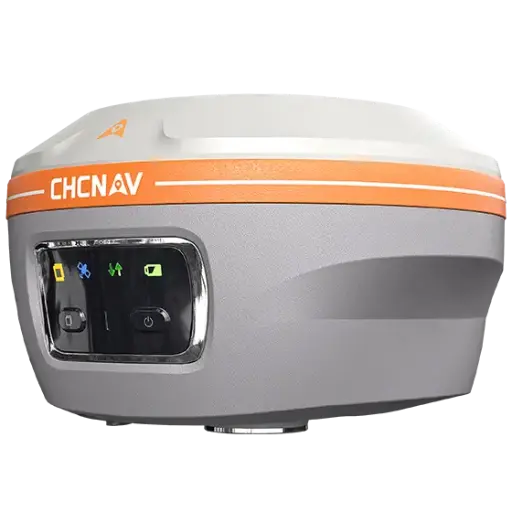
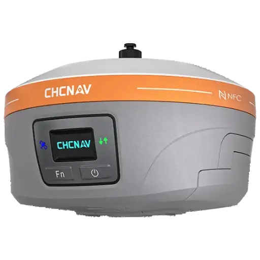
| Spec | i76 | i85 | iBase | ViLi i100 |
|---|---|---|---|---|
| Role | Palm-sized visual RTK rover (base or rover) | Laser IMU-RTK rover | Dedicated GNSS base station | Visual-LiDAR RTK flagship rover |
| Channels | 1892 (StellaX) | 1892 | 1408 | 1408 (iStar2.0) |
| Constellations | GPS, GLONASS, Galileo, BeiDou, QZSS, NavIC, SBAS + PPP | GPS, GLONASS, Galileo, BeiDou, QZSS, NavIC, SBAS + PointSky | GPS, GLONASS, Galileo, BeiDou, QZSS, SBAS + PPP | GPS, GLONASS, Galileo, BeiDou, QZSS, NavIC, SBAS |
| RTK accuracy H | 8 mm + 1 ppm RMS | 8 mm + 1 ppm RMS | 8 mm + 1 ppm RMS | 8 mm + 1 ppm RMS |
| RTK accuracy V | 15 mm + 1 ppm RMS | 15 mm + 1 ppm RMS | 15 mm + 1 ppm RMS | 15 mm + 1 ppm RMS |
| PPK accuracy | H 3 mm / V 5 mm + 1 ppm | H 3 mm / V 5 mm + 1 ppm | H 3 mm / V 5 mm + 1 ppm | H 3 mm / V 5 mm + 1 ppm |
| IMU / tilt | 200 Hz AUTO-IMU, tilt to 60° | 200 Hz AUTO-IMU, tilt to 60° | 200 Hz AUTO-IMU (base-station unit) | 200 Hz; 360° tilt compensation |
| Cameras / vision | Dual 2 MP, 95° FOV; CAD AR visual stakeout | Dual 2 MP + 8 MP, 91° FOV; AR stakeout | None | 8 MP telephoto + dual 2 MP colour + AR camera (4 total) |
| Laser / LiDAR extra | — | Green laser Class 3R, up to 150 m (2 cm @ 5 m) | — | 96-line LiDAR, 860,544 pts/s; SFix 2.0 ±5 cm within 20 m GNSS-denied; Vi-LiDAR ±5 cm @ 15 m |
| UHF radio | Tx/Rx 410–470 MHz, 0.5/1 W | Tx/Rx 410–470 MHz, 0.5/1 W | Tx/Rx 410–470 MHz, up to 5 W | Rx only, 410–470 MHz |
| Radio range | Up to 15 km in base mode (DistLink) | Typical 6 km, optimal up to 15 km | Typical 8–12 km; DistLink up to 30 km | Receive only — range set by the base used |
| Battery / runtime | Built-in 4900 mAh; up to 17 h rover, 22 h static | 4900 mAh; up to 20 h rover, 15 h laser survey | 2 × 7000 mAh; up to 13 h base, 25 h static | 9900 mAh; ~22 h RTK, ~5 h scanning |
| Storage | 8 GB | 8 GB | 8 GB | 64 GB (expandable to 1 TB) |
| Weight | 450 g | 800 g | 1.73 kg | 1.39 kg |
| Size | Φ106 × 55.6 mm | Φ134 × 86 mm | Φ160.5 × 103 mm | 208 × 162 × 95.5 mm |
| Ingress protection | IP68 | IP68 | IP67 | IP67 |
| Operating temperature | −40 °C to +65 °C | −40 °C to +65 °C | −40 °C to +65 °C | −20 °C to +55 °C |
Specifications are CHCNAV published figures and are subject to change without notice.
Still deciding?
Try the receiver that fits your work for two weeks — on your own jobs, with your own crew.