CHCNAV · HANDHELD SCANNER
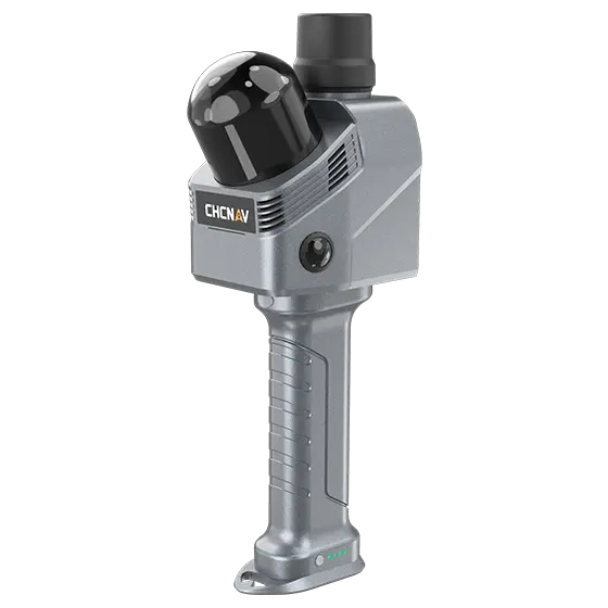
RS7 Handheld LiDAR Scanner
Walk a site, a room or a stockpile and capture a colorized 3D record in one pass — no tripod, and no return trip for detail you missed. Built for as-builts, interiors and BIM documentation, with built-in GNSS to georeference outdoor scans.
$ 9,999.00
Specifications
| LiDAR | 64-channel |
|---|---|
| Measurement rate | 576,000 pts/s single return; 1,152,000 pts/s dual return |
| Range | 40 m @ 10% reflectivity |
| Field of view | 360° × 189° |
| Laser | Class 1 eye-safe, 905 nm |
| Absolute accuracy | H < 3 cm RMS, V < 3 cm RMS |
| Relative accuracy / repeatability | < 1 cm / < 2 cm |
| Cameras | Dual cameras, 48 MP, combined FOV 340° (H) × 360° (V), 1/2″ sensors |
| IMU | 500 Hz update rate; gyro bias instability 0.5°/h |
| GNSS (georeferencing) | GPS L1/L2/L5, GLONASS L1/L2, BeiDou B1/B2/B3, Galileo E1/E5a/E5b |
| Storage | 512 GB |
| Battery | Integrated in handle, 47.5 Wh; working time 150 min |
| Weight | 1,200 g (with battery handle) |
| Ingress protection | IP64 |
| Software | SmartGo (field), CoPre, CoProcess 2025, CoCloud; colorized point clouds, mesh and 3D Gaussian Splatting outputs |
Specifications are CHCNAV published figures and are subject to change without notice.
Scan a real job before you buy.
Put the RS7 in your crew’s hands for two weeks.